
1944 Map of West Plains
USGS Topo · Published 1957About this map
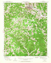
West Plains serves as the primary hub of this 1944 survey, situated at the junction of the St Louis - San Francisco railroad and several local highways. The town's layout includes civic and recreation sites like American Legion Field, the County Home, and a Sewage Disposal plant. Extending south toward the Missouri Arkansas state line, the landscape is defined by a dense network of rural one-room schools such as Homeland Sch, Valley View Sch, and Neubarger Sch.
Find a feature on this map
79 named features on this map. Tap any name to fly to it.
Don’t see what you’re looking for? This feature index may not catch every label — zoom into the map to look around manually.
Map Details
Editions of this 1944 West Plains Map
2 editions found
Other maps of this area

1890 · Mountain Home
USGS Topo · 1:125,000

1891 · Mountain Home
USGS Topo · 1:125,000

1894 · Mountain Home
USGS Topo · 1:125,000

1938 · West Plains
USGS Topo · 1:24,000

1939 · Topaz
USGS Topo · 1:62,500

1940 · West Plains
USGS Topo · 1:24,000

1941 · Topaz
USGS Topo · 1:62,500

1943 · Thayer
USGS Topo · 1:62,500

1944 · Cureall
USGS Topo · 1:62,500

1945 · Harrison
USGS Topo · 1:250,000