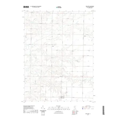
2021 Map of West Point
USGS Topo · Published 2021About this map
The villages of Basco and West Point anchor this Hancock County landscape, where the agricultural grid of the Illinois prairie is deeply etched by the winding drainage of the Bear Cr watershed. In the early 2020s, this area remains defined by its rural heritage and a remarkably high density of small family and community burial grounds that track generations of local history. From the Immanuel Lutheran Cem in the northeast to the Cook Cem in the west, these sites are tucked into the breaks of the terrain where headwaters like Slater Cr and W Fork Bear Cr begin their descent. The road network, including Co RD 11 and W Main St, connects these dispersed settlements across a landscape where industrial-scale farming meets the intricate timbered draws of Little Bear Cr and Panther Cr.
Find a feature on this map
53 named features on this map. Tap any name to fly to it.
Don’t see what you’re looking for? This feature index may not catch every label — zoom into the map to look around manually.
Map Details
Editions of this 2021 West Point Map
This is the sole edition of this map. No revisions or reprints were ever made.
Other maps of this area

1933 · Carthage
USGS Topo · 1:62,500

1936 · Keokuk
USGS Topo · 1:62,500

1937 · Carthage
USGS Topo · 1:62,500

1946 · Mendon
USGS Topo · 1:62,500

1948 · Mendon
USGS Topo · 1:62,500

1948 · Camp Point
USGS Topo · 1:62,500

1950 · Keokuk
USGS Topo · 1:62,500

1958 · Burlington
USGS Topo · 1:250,000

1961 · Burlington
USGS Topo · 1:250,000

1963 · Burlington
USGS Topo · 1:250,000