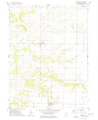
1974 Map of West Point
USGS Topo · Published 1978About this map
Basco and West Point anchor this rural landscape in the mid-1970s, where the agricultural grid is interrupted by the winding tributaries of Bear Creek. The terrain is marked by an Old Railroad Grade that cuts north-south through Bear Creek and St Albans townships, tracing a former transportation corridor that once linked these small farming communities. Numerous family and community burial grounds, including Cook Cem, Payne Cem, and Graham Cem, are scattered across the township boundaries of Prairie and Harmony, suggesting a long-settled history tied to the land. In the village of West Point, Pierce Park and the West Point Cem serve as central landmarks for the local population. The map also documents drainage modifications like the Big Ditch and Meadow Br 607, reflecting efforts to manage the water flowing toward the West Fork Bear Creek.
Find a feature on this map
24 named features on this map. Tap any name to fly to it.
Don’t see what you’re looking for? This feature index may not catch every label — zoom into the map to look around manually.
Map Details
Editions of this 1974 West Point Map
This is the sole edition of this map. No revisions or reprints were ever made.
Other maps of this area

1933 · Carthage
USGS Topo · 1:62,500

1936 · Keokuk
USGS Topo · 1:62,500

1937 · Carthage
USGS Topo · 1:62,500

1946 · Mendon
USGS Topo · 1:62,500

1948 · Mendon
USGS Topo · 1:62,500

1948 · Camp Point
USGS Topo · 1:62,500

1950 · Keokuk
USGS Topo · 1:62,500

1958 · Burlington
USGS Topo · 1:250,000

1961 · Burlington
USGS Topo · 1:250,000

1963 · Burlington
USGS Topo · 1:250,000