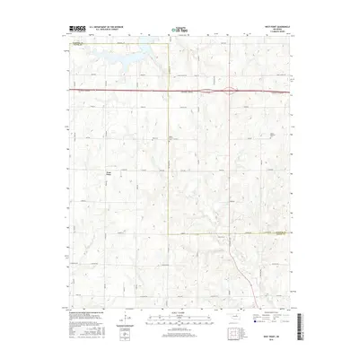
2016 Map of West Point
USGS Topo · Published 2016About this map
West Point sits at the heart of this North Central Oklahoma landscape, where the boundary between Pawnee and Payne Counties shapes the local geography. The area's rural character is defined by a dense network of sectional roads and the prominent path of the Cimarron Turnpike, which cuts across the northern half of the quadrangle. Local history and genealogy are well-preserved through several family and community burial grounds, including Hopp Cem, Mount Vernon Cem, and Mount Pleasant Cem. The terrain is drained by the winding courses of Salt Cr and Feather Cr, which move through the rolling topography north of E McElroy Rd. Distinctive local landmarks such as N Twin Mounds and N Council Vly highlight the unique naming conventions and geographic features of this transition between the prairie and the Cross Timbers region.
Find a feature on this map
38 named features on this map. Tap any name to fly to it.
Don’t see what you’re looking for? This feature index may not catch every label — zoom into the map to look around manually.
Map Details
Editions of this 2016 West Point Map
This is the sole edition of this map. No revisions or reprints were ever made.
Other maps of this area

1929 · Yale
USGS Topo · 1:62,500

1929 · Ripley
USGS Topo · 1:62,500

1929 · Skedee
USGS Topo · 1:62,500

1930 · Pawnee
USGS Topo · 1:62,500

1931 · Skedee
USGS Topo · 1:62,500

1932 · Yale
USGS Topo · 1:62,500

1932 · Ripley
USGS Topo · 1:62,500

1936 · Pawnee
USGS Topo · 1:62,500

1955 · Enid
USGS Topo · 1:250,000

1958 · Enid
USGS Topo · 1:250,000