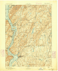
1894 Map of West Point
USGS Topo · Published 1894About this map
Hudson River navigation and military history dominate this late 19th-century study, centered on the strategic narrows of the Highlands. The map meticulously documents the fortifications at West Point, including Ft Putnam and the surrounding heights like Storm King and Anthonys Nose. Industrial and transit corridors are well-defined, showing the competing routes of the New York Central and Hudson River Railroad on the eastern bank and the West Shore Railroad on the west. Inland, the transition from river economy to upland agriculture and mining is evident through features like the Mahopac Mines and the network of post roads, including the historic Albany Post Road. Numerous small settlements such as Garrison, Highland Falls, and Peekskill serve as anchors for local genealogy, while topographic details reveal the complex drainage systems of Canopus Creek and Sprout Brook.
Find a feature on this map
113 named features on this map. Tap any name to fly to it.
Don’t see what you’re looking for? This feature index may not catch every label — zoom into the map to look around manually.
Map Details
Editions of this 1894 West Point Map
3 editions found

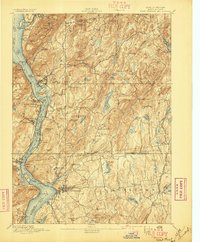
Other maps of this area

1891 · Ramapo
USGS Topo · 1:62,500

1892 · Stamford
USGS Topo · 1:62,500

1892 · West Point
USGS Topo · 1:62,500

1892 · Carmel
USGS Topo · 1:62,500

1892 · Tarrytown
USGS Topo · 1:62,500

1893 · Carmel
USGS Topo · 1:62,500

1893 · Stamford
USGS Topo · 1:62,500

1893 · Tarrytown
USGS Topo · 1:62,500

1893 · Ramapo
USGS Topo · 1:62,500

1893 · Clove
USGS Topo · 1:62,500