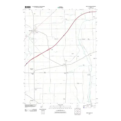
2010 Map of West Salem
USGS Topo · Published 2010About this map
The village of West Salem sits at the northern edge of this agricultural landscape in Wayne County, defined by the winding paths of Killbuck Creek and its tributary, Little Killbuck Creek. The area maintains its rural character through the turn of the 21st century, centered on small crossroads like Congress and Pleasant Home. A unique aviation landmark, the Pleasant Home Gliding Club Gliderport, is situated just west of the latter, taking advantage of the open fields.
Find a feature on this map
69 named features on this map. Tap any name to fly to it.
Don’t see what you’re looking for? This feature index may not catch every label — zoom into the map to look around manually.
Map Details
Editions of this 2010 West Salem Map
This is the sole edition of this map. No revisions or reprints were ever made.
Other maps of this area

1901 · Wooster
USGS Topo · 1:62,500

1903 · Wooster
USGS Topo · 1:62,500

1904 · Medina
USGS Topo · 1:62,500

1904 · Wellington
USGS Topo · 1:62,500

1906 · Medina
USGS Topo · 1:62,500

1906 · Wellington
USGS Topo · 1:62,500

1906 · West Salem
USGS Topo · 1:62,500

1908 · West Salem
USGS Topo · 1:62,500

1950 · Cleveland
USGS Topo · 1:250,000

1950 · Marion
USGS Topo · 1:250,000