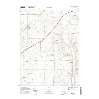
2016 Map of West Salem
USGS Topo · Published 2016About this map
West Salem and Burbank anchor this survey of the northern Wayne County border, where the landscape is defined by the headwaters of Killbuck Creek and its many tributaries like Repp Run and Little Killbuck Creek. The map reveals a dense network of township roads and family-named landmarks that speak to the area's agricultural foundations. Numerous small burial grounds are scattered throughout the countryside, including the Old Dutch Reformed Cemetery and Warners Congress Cemetery near the village of Congress. The terrain features several notable water bodies like Boreman Lake and Mowrer Lake, while the eastern portion is marked by the distinctive elevation of Bald Knob. This record provides a clear view of the intersection of rural life and natural drainage patterns, from the Muddy Fork in the west to the small settlements of Aukerman and Armstrong in the east.
Find a feature on this map
97 named features on this map. Tap any name to fly to it.
Don’t see what you’re looking for? This feature index may not catch every label — zoom into the map to look around manually.
Map Details
Editions of this 2016 West Salem Map
This is the sole edition of this map. No revisions or reprints were ever made.
Other maps of this area

1901 · Wooster
USGS Topo · 1:62,500

1903 · Wooster
USGS Topo · 1:62,500

1904 · Medina
USGS Topo · 1:62,500

1904 · Wellington
USGS Topo · 1:62,500

1906 · Medina
USGS Topo · 1:62,500

1906 · Wellington
USGS Topo · 1:62,500

1906 · West Salem
USGS Topo · 1:62,500

1908 · West Salem
USGS Topo · 1:62,500

1950 · Cleveland
USGS Topo · 1:250,000

1950 · Marion
USGS Topo · 1:250,000