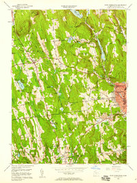
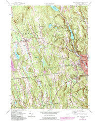
1956 Map of West Torrington
USGS Topo · Published 1958About this map
John Browns Birthplace (Ruins) sits near Brandy Hill in the hills of Northwest Connecticut, a significant historical marker for the abolitionist movement. This mid-century survey reveals a landscape of transition between the industrial concentration in Torrington and the upland agricultural and institutional character of Goshen and Litchfield. The map documents a dense network of educational and social institutions, including the Junior Republic of Connecticut, the Litchfield School for Boys, and the St Louis De Montfort Seminary.
Find a feature on this map
77 named features on this map. Tap any name to fly to it.
Don’t see what you’re looking for? This feature index may not catch every label — zoom into the map to look around manually.
Map Details
Editions of this 1956 West Torrington Map
5 editions found
Other maps of this area

1892 · Winsted
USGS Topo · 1:62,500

1892 · Cornwall
USGS Topo · 1:62,500

1892 · New Milford
USGS Topo · 1:62,500

1893 · Waterbury
USGS Topo · 1:62,500

1893 · New Milford
USGS Topo · 1:62,500

1893 · Cornwall
USGS Topo · 1:62,500

1903 · Cornwall
USGS Topo · 1:62,500

1904 · New Milford
USGS Topo · 1:62,500

1904 · Waterbury
USGS Topo · 1:62,500

1904 · Litchfield
USGS Topo · 1:125,000