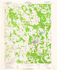
1961 Map of West Union
USGS Topo · Published 1962About this map
West Union serves as the focal point of this 1961 survey, situated within the rolling landscapes of the Virginia Military District. This era shows a community defined by its civic and social institutions, from the County Fairgrounds on the town's edge to the Childrens Home and County Hospital. The surrounding countryside in townships like Tiffin and Liberty is dotted with rural landmarks that suggest a history of family-centered settlement, including the Kirker Cemetery and the IOOF Cemetery. Numerous country churches such as Nixon Chapel and Liberty Chapel are scattered throughout the hills, connected by a network of winding roads and local forks. The presence of Adams Lake State Reserve and Adams Lake provides a clear landmark northeast of the village, where the Lick Fork meets the wooded hillsides. Further south, the small settlement of Bentonville marks the corner of Sprigg township, anchoring a landscape where agriculture and small-town life remained the primary rhythm of Adams County.
Find a feature on this map
35 named features on this map. Tap any name to fly to it.
Don’t see what you’re looking for? This feature index may not catch every label — zoom into the map to look around manually.
Map Details
Editions of this 1961 West Union Map
3 editions found
Other maps of this area

1916 · Peebles
USGS Topo · 1:62,500

1918 · Peebles
USGS Topo · 1:62,500

1918 · Seaman
USGS Topo · 1:62,500

1919 · Vanceburg
USGS Topo · 1:62,500

1929 · Springdale
USGS Topo · 1:48,000

1935 · Springdale
USGS Topo · 1:62,500

1949 · Vanceburg
USGS Topo · 1:62,500

1949 · Concord
USGS Topo · 1:24,000
1951 · Concord
USGS Topo · 1:24,000

1952 · Maysville East
USGS Topo · 1:24,000