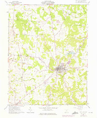
1961 Map of West Union
USGS Topo · Published 1975About this map
West Union serves as the focal point of this topographic study, situated at the intersection of local commerce and the hilly terrain of the Virginia Military District. The village is densely detailed with municipal landmarks including the County Fairgrounds, Childrens Home, and the IOOF Cem. Moving away from the town center, the landscape is defined by the winding course of Eagle Creek and its tributaries, where the Covered Bridge marks a traditional crossing point near the Kirker Cem.
Find a feature on this map
38 named features on this map. Tap any name to fly to it.
Don’t see what you’re looking for? This feature index may not catch every label — zoom into the map to look around manually.
Map Details
Editions of this 1961 West Union Map
3 editions found
Other maps of this area

1916 · Peebles
USGS Topo · 1:62,500

1918 · Peebles
USGS Topo · 1:62,500

1918 · Seaman
USGS Topo · 1:62,500

1919 · Vanceburg
USGS Topo · 1:62,500

1929 · Springdale
USGS Topo · 1:48,000

1935 · Springdale
USGS Topo · 1:62,500

1949 · Vanceburg
USGS Topo · 1:62,500

1949 · Concord
USGS Topo · 1:24,000
1951 · Concord
USGS Topo · 1:24,000

1952 · Maysville East
USGS Topo · 1:24,000