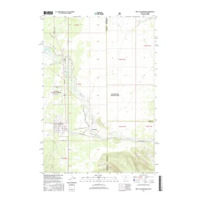
2017 Map of West Yellowstone
USGS Topo · Published 2017About this map
West Yellowstone serves as a critical gateway to the interior of Yellowstone National Park, anchoring the intersection of several forest roads and trails at the edge of the Gallatin National Forest. The Madison River dominates the central drainage, flowing past the settlement of Riverside and under the Madison River Bridge before heading toward Hebgen Lake to the northwest. This modern survey illustrates the complex transportation network required to support the region's tourism and transit, including the Yellowstone Airport and the transition into W Entrance Road. Hikers and outdoor researchers can trace the detailed path of the Down River Loop Trail and the Up River Loop Trail, while the map also delineates the state and county boundaries that meet in this unique corner of the American West.
Find a feature on this map
30 named features on this map. Tap any name to fly to it.
Don’t see what you’re looking for? This feature index may not catch every label — zoom into the map to look around manually.
Map Details
Editions of this 2017 West Yellowstone Map
This is the sole edition of this map. No revisions or reprints were ever made.
Other maps of this area

1885 · Gallatin
USGS Topo · 1:125,000

1885 · Gallatin
USGS Topo · 1:125,000

1901 · Gallatin
USGS Topo · 1:125,000

1908 · Gallatin
USGS Topo · 1:125,000

1911 · Gallatin
USGS Topo · 1:125,000

1955 · Ashton
USGS Topo · 1:250,000

1958 · Ashton
USGS Topo · 1:250,000

1958 · Madison Junction
USGS Topo · 1:62,500

1958 · Mount Holmes
USGS Topo · 1:62,500

1958 · West Yellowstone
USGS Topo · 1:62,500