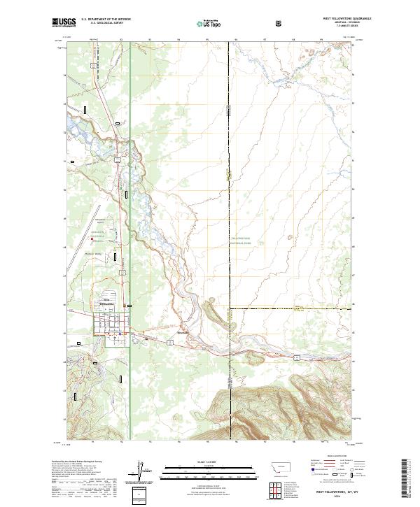
2024 Map of West Yellowstone
USGS Topo · Published 2024About this map
West Yellowstone sits at the vital western gateway to Yellowstone National Park, defined by its grid of streets such as Madison Ave and Yellowstone Ave. The landscape transitions from the developed corridor of the Yellowstone Airport and Gallatin Rd into the vast wooded tracts of the Gallatin National Forest. To the east, the boundary between Montana and Wyoming cuts through the terrain near the settlement of Riverside, where the Madison River flows through the Madison Valley. This modern survey reveals a complex network of recreational paths and access routes, including the Down River Loop Trl, Purple Haze (Xc) Trl, and Rendezvous Trl, which weave through the timber and valley floor. These trails, alongside roads like Whiskey Springs Rd, illustrate the area's contemporary role as a premier hub for high-altitude outdoor navigation and park access.
Find a feature on this map
53 named features on this map. Tap any name to fly to it.
Don’t see what you’re looking for? This feature index may not catch every label — zoom into the map to look around manually.
Map Details
Editions of this 2024 West Yellowstone Map
This is the sole edition of this map. No revisions or reprints were ever made.
Other maps of this area

1885 · Gallatin
USGS Topo · 1:125,000

1885 · Gallatin
USGS Topo · 1:125,000

1901 · Gallatin
USGS Topo · 1:125,000

1908 · Gallatin
USGS Topo · 1:125,000

1911 · Gallatin
USGS Topo · 1:125,000

1955 · Ashton
USGS Topo · 1:250,000

1958 · Ashton
USGS Topo · 1:250,000

1958 · Madison Junction
USGS Topo · 1:62,500

1958 · Mount Holmes
USGS Topo · 1:62,500

1958 · West Yellowstone
USGS Topo · 1:62,500