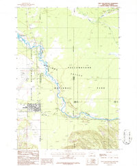
1986 Map of West Yellowstone
USGS Topo · Published 1987About this map
West Yellowstone serves as the focal point of this 1980s landscape, positioned at the critical junction of the Gallatin National Forest and Yellowstone National Park. The town's grid is clearly defined, showing its development as a primary gateway to the park, supported by infrastructure including the Yellowstone Airport, a Heliport, and a Radio Facility. The Madison River meanders through the Madison Valley, joined by tributaries like Maple Creek and Cougar Creek as it flows toward Hebgen Lake.
Find a feature on this map
21 named features on this map. Tap any name to fly to it.
Don’t see what you’re looking for? This feature index may not catch every label — zoom into the map to look around manually.
Map Details
Editions of this 1986 West Yellowstone Map
This is the sole edition of this map. No revisions or reprints were ever made.
Other maps of this area

1885 · Gallatin
USGS Topo · 1:125,000

1885 · Gallatin
USGS Topo · 1:125,000

1901 · Gallatin
USGS Topo · 1:125,000

1908 · Gallatin
USGS Topo · 1:125,000

1911 · Gallatin
USGS Topo · 1:125,000

1955 · Ashton
USGS Topo · 1:250,000

1958 · Ashton
USGS Topo · 1:250,000

1958 · Madison Junction
USGS Topo · 1:62,500

1958 · Mount Holmes
USGS Topo · 1:62,500

1958 · West Yellowstone
USGS Topo · 1:62,500