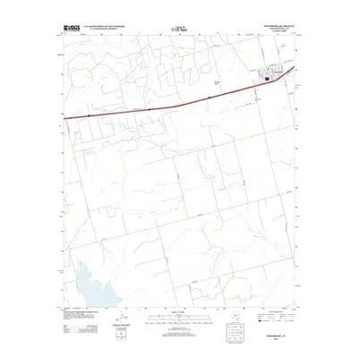
2012 Map of Westbrook
USGS Topo · Published 2012About this map
Westbrook sits at the intersection of local history and modern transit, centered where Interstate 20 and State Loop 333 meet the traditional street grid of Morgan St and Bird St. This West Texas landscape is defined by the winding paths of Wildhorse Cr and Morgan Cr, which cut through the ranchlands of Mitchell County. For those tracing local roots, the Westbrook Cem remains a primary landmark south of the main settlement. The terrain is largely flat, punctuated by the distinct elevation of Morgan Peak to the west. This 2012 survey illustrates the transition of the area from a classic railway-aligned town into a community structured by modern ranch-to-market roads like Ranch Road 670 and an extensive network of county roads including Co Rd-252 and Co Rd-262.
Find a feature on this map
33 named features on this map. Tap any name to fly to it.
Don’t see what you’re looking for? This feature index may not catch every label — zoom into the map to look around manually.
Map Details
Editions of this 2012 Westbrook Map
This is the sole edition of this map. No revisions or reprints were ever made.
Other maps of this area

1950 · Cedar Bend
USGS Topo · 1:24,000

1950 · Lake Colorado City
USGS Topo · 1:24,000

1951 · Vincent
USGS Topo · 1:24,000

1951 · Iatan
USGS Topo · 1:24,000

1952 · Iatan
USGS Topo · 1:24,000

1952 · Cuthbert
USGS Topo · 1:24,000

1952 · Westbrook
USGS Topo · 1:24,000

1954 · Big Spring
USGS Topo · 1:250,000

1958 · Big Spring
USGS Topo · 1:250,000

1959 · Spade Ranch
USGS Topo · 1:24,000