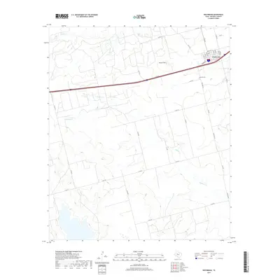
2019 Map of Westbrook
USGS Topo · Published 2019About this map
Westbrook sits in the northeast corner of this Mitchell County landscape, a town defined by its grid of streets such as Thorne St, Lincoln St, and Grady St. The surrounding countryside is marked by drainage systems including Wildhorse Creek, which meanders across the central and southern sections, and Morgan Creek to the north. Elevated above the plains, Morgan Peak serves as a prominent landmark in the north-central area. The map documents the rural infrastructure of the late 2010s, showing the intersection of local roads like Ranch Rd 670 and the established Westbrook Cemetery located just south of the town center. This survey provides a clear view of the ranching and agricultural transport network that characterizes this part of the West Texas plains.
Find a feature on this map
32 named features on this map. Tap any name to fly to it.
Don’t see what you’re looking for? This feature index may not catch every label — zoom into the map to look around manually.
Map Details
Editions of this 2019 Westbrook Map
This is the sole edition of this map. No revisions or reprints were ever made.
Other maps of this area

1950 · Cedar Bend
USGS Topo · 1:24,000

1950 · Lake Colorado City
USGS Topo · 1:24,000

1951 · Vincent
USGS Topo · 1:24,000

1951 · Iatan
USGS Topo · 1:24,000

1952 · Iatan
USGS Topo · 1:24,000

1952 · Cuthbert
USGS Topo · 1:24,000

1952 · Westbrook
USGS Topo · 1:24,000

1954 · Big Spring
USGS Topo · 1:250,000

1958 · Big Spring
USGS Topo · 1:250,000

1959 · Spade Ranch
USGS Topo · 1:24,000