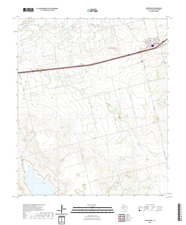
2022 Map of Westbrook
USGS Topo · Published 2022About this map
Westbrook stands as the central hub of this West Texas landscape, where the local street grid is defined by names such as Thorne St, Morrison St, and Padgitt St. The town sits positioned near the intersection of the primary transportation corridor and Ranch Rd 670, serving a ranching and agricultural region that has relied on this geography for generations. To the south of the main settlement lies the Westbrook Cem, a critical site for genealogical research in Mitchell County.
Find a feature on this map
35 named features on this map. Tap any name to fly to it.
Don’t see what you’re looking for? This feature index may not catch every label — zoom into the map to look around manually.
Map Details
Editions of this 2022 Westbrook Map
This is the sole edition of this map. No revisions or reprints were ever made.
Other maps of this area

1950 · Cedar Bend
USGS Topo · 1:24,000

1950 · Lake Colorado City
USGS Topo · 1:24,000

1951 · Vincent
USGS Topo · 1:24,000

1951 · Iatan
USGS Topo · 1:24,000

1952 · Iatan
USGS Topo · 1:24,000

1952 · Cuthbert
USGS Topo · 1:24,000

1952 · Westbrook
USGS Topo · 1:24,000

1954 · Big Spring
USGS Topo · 1:250,000

1958 · Big Spring
USGS Topo · 1:250,000

1959 · Spade Ranch
USGS Topo · 1:24,000