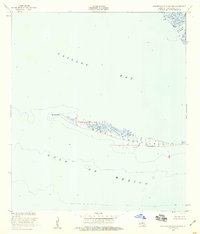
1953 Map of Western Isles Dernieres
USGS Topo · Published 1959About this map
Isles Dernieres stretches across this mid-century survey, illustrating the fragile barrier islands of Louisiana's Gulf Coast. Situated between Caillou Bay and the open Gulf of Mexico, the archipelago is defined by shifting sands and tidal inlets. The map details the western reaches of the chain, including Raccoon Point and Coon Point, where the low-lying terrain is punctuated by small marshy lagoons. A lone Oil Well to the north reflects the encroaching industrial interest in these offshore waters during the 1950s. The cartography provides a baseline for coastal change, marking ephemeral water passages like Coupe Colin and Grand Pass des Ilettes. This 1953 record is essential for understanding the geomorphology of the Terrebonne Parish coastline before later decades of significant erosion altered these landforms.
Find a feature on this map
11 named features on this map. Tap any name to fly to it.
Don’t see what you’re looking for? This feature index may not catch every label — zoom into the map to look around manually.
Map Details
Editions of this 1953 Western Isles Dernieres Map
4 editions found
Other maps of this area

1935 · Oyster Bayou
USGS Topo · 1:62,500

1945 · New Orleans
USGS Topo · 1:250,000
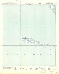
1947 · West Derniere
USGS Topo · 1:31,680

1949 · Grand Bayou Du Large
USGS Topo · 1:31,680
1949 · Dog Lake
USGS Topo · 1:31,680
1950 · Derniere
USGS Topo · 1:31,680
1953 · Central Isles Dernieres
USGS Topo · 1:24,000
1953 · Dog Lake
USGS Topo · 1:24,000
1953 · Grand Bayou Du Large
USGS Topo · 1:24,000
1957 · Oyster Bayou
USGS Topo · 1:62,500