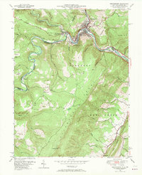
1950 Map of Westernport
USGS Topo · Published 1970About this map
Potomac River industry and coal-country topography dominate this 1950s survey of the borderlands between Maryland and West Virginia. The river corridor is a dense concentration of settlement and rail infrastructure, centered on the mill town of Luke and the adjacent transport hubs of Westernport and Piedmont. Multiple rail lines, including the Western Maryland and the Baltimore and Ohio, trace the river's winding path through the gap between Franklin Hill and Hampshire Hill.
Find a feature on this map
60 named features on this map. Tap any name to fly to it.
Don’t see what you’re looking for? This feature index may not catch every label — zoom into the map to look around manually.
Map Details
Editions of this 1950 Westernport Map
3 editions found
Other maps of this area

1891 · Romney
USGS Topo · 1:125,000

1895 · Piedmont
USGS Topo · 1:125,000

1898 · Frostburg
USGS Topo · 1:62,500

1899 · Grantsville
USGS Topo · 1:62,500

1901 · Frostburg
USGS Topo · 1:62,500

1904 · Grantsville
USGS Topo · 1:62,500

1908 · Frostburg
USGS Topo · 1:62,500

1919 · Elk Garden
USGS Topo · 1:48,000

1920 · Elk Garden
USGS Topo · 1:48,000

1920 · Keyser
USGS Topo · 1:62,500