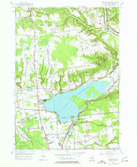
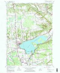
1955 Map of Westernville
USGS Topo · Published 1957About this map
Delta Reservoir dominates the center of this mid-century survey, its expansive waters fed by the Mohawk River as it flows south toward the Rome City Boundary. This landscape in northern Oneida County is defined by the sharp contrast between the broad reservoir and the high elevations of Quaker Hill and Mullen Hill to the north. The village of Westernville sits at the northeastern edge of the water, a hub for a surrounding rural network of family-named landmarks like Stokes Corner and Hawkins Corner.
Find a feature on this map
46 named features on this map. Tap any name to fly to it.
Don’t see what you’re looking for? This feature index may not catch every label — zoom into the map to look around manually.
Map Details
Editions of this 1955 Westernville Map
5 editions found
Other maps of this area

1895 · Oriskany
USGS Topo · 1:62,500

1895 · Oneida
USGS Topo · 1:62,500

1898 · Oneida
USGS Topo · 1:62,500

1898 · Oriskany
USGS Topo · 1:62,500

1902 · Oneida
USGS Topo · 1:62,500

1904 · Boonville
USGS Topo · 1:62,500

1905 · Taberg
USGS Topo · 1:62,500

1939 · Oneida
USGS Topo · 1:62,500

1943 · Lee Center
USGS Topo · 1:31,680

1944 · Point Rock
USGS Topo · 1:31,680