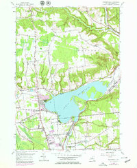
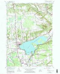
1955 Map of Westernville
USGS Topo · Published 1978About this map
The Delta Reservoir dominates this landscape north of Rome, drowning the valley where the village of Delta once stood before the dam was completed. The expansive waters now serve as the centerpiece for Delta Lake State Park, while the surrounding terrain rises toward prominent heights like Tripp Pinnacle and Haynes Hill. Significant water infrastructure and recreation sites are mapped throughout the area, including the Rome Fish Hatchery and the C & MA Campground along the western shore.
Find a feature on this map
58 named features on this map. Tap any name to fly to it.
Don’t see what you’re looking for? This feature index may not catch every label — zoom into the map to look around manually.
Map Details
Editions of this 1955 Westernville Map
5 editions found
Other maps of this area

1895 · Oriskany
USGS Topo · 1:62,500

1895 · Oneida
USGS Topo · 1:62,500

1898 · Oneida
USGS Topo · 1:62,500

1898 · Oriskany
USGS Topo · 1:62,500

1902 · Oneida
USGS Topo · 1:62,500

1904 · Boonville
USGS Topo · 1:62,500

1905 · Taberg
USGS Topo · 1:62,500

1939 · Oneida
USGS Topo · 1:62,500

1943 · Lee Center
USGS Topo · 1:31,680

1944 · Point Rock
USGS Topo · 1:31,680