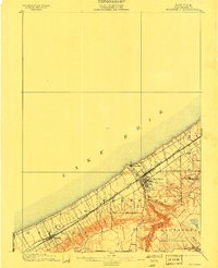
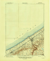
1899 Map of Westfield
USGS Topo · Published 1911About this map
Lake Erie defines the northern edge of this Chautauqua County landscape, where the narrow coastal plain meets the rising Escarpment. This 1898 survey illustrates a transportation-heavy corridor, dominated by the parallel tracks of the Lake Shore and Michigan Southern and the New York Chicago and St. Louis railroads. These lines connect the established village of Westfield and the settlement of Ripley to the broader industrial Great Lakes network.
Find a feature on this map
17 named features on this map. Tap any name to fly to it.
Don’t see what you’re looking for? This feature index may not catch every label — zoom into the map to look around manually.
Map Details
Editions of this 1899 Westfield Map
6 editions found
Other maps of this area

1899 · Westfield
USGS Topo · 1:62,500

1900 · Dunkirk
USGS Topo · 1:62,500

1904 · Chautaqua
USGS Topo · 1:62,500

1905 · Clymer
USGS Topo · 1:62,500

1913 · North East
USGS Topo · 1:62,500

1915 · North East
USGS Topo · 1:62,500

1939 · Clymer
USGS Topo · 1:62,500

1941 · Chautauqua
USGS Topo · 1:62,500

1941 · Clymer
USGS Topo · 1:62,500

1943 · North East
USGS Topo · 1:62,500