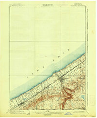
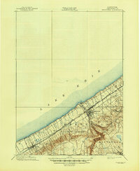
1899 Map of Westfield
USGS Topo · Published 1938About this map
Lake Erie defines the northern edge of this Chautauqua County landscape, where the narrow coastal plain transitions into the steep ridges of the Ripley and Westfield districts. At the turn of the century, the region's economy was anchored by a dense corridor of transportation infrastructure squeezed between the shoreline and the hills. Three major rail lines, including the Lake Shore and Michigan Southern R. R. and the New York Chicago and St Louis R. R., parallel the coast, facilitating the movement of goods through settlements like Forsyth and Ripley. Inland, the terrain rises sharply toward the village of Mayville, which sits near the head of the Inlet. This topography created a distinct settlement pattern where coastal ports like Barcelona served as gateways at the mouth of Chautauqua Creek, while upland hamlets such as Volusia and Lombard remained isolated by the deeply carved ravines of the lake's tributaries.
Find a feature on this map
18 named features on this map. Tap any name to fly to it.
Don’t see what you’re looking for? This feature index may not catch every label — zoom into the map to look around manually.
Map Details
Editions of this 1899 Westfield Map
6 editions found
Other maps of this area

1899 · Westfield
USGS Topo · 1:62,500

1900 · Dunkirk
USGS Topo · 1:62,500

1904 · Chautaqua
USGS Topo · 1:62,500

1905 · Clymer
USGS Topo · 1:62,500

1913 · North East
USGS Topo · 1:62,500

1915 · North East
USGS Topo · 1:62,500

1939 · Clymer
USGS Topo · 1:62,500

1941 · Chautauqua
USGS Topo · 1:62,500

1941 · Clymer
USGS Topo · 1:62,500

1943 · North East
USGS Topo · 1:62,500