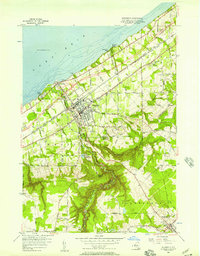
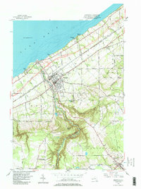
1954 Map of Westfield
USGS Topo · Published 1957About this map
Westfield serves as the focal point of this Chautauqua County survey, showing the village at a moment of significant infrastructure transition as the New York State Thruway cuts through the landscape. This new artery passes just north of the village center, crossing Chautauqua Creek and introducing Interchange 60 near Barcelona on the shores of Lake Erie. The map documents a dense network of transportation, where the New York Chicago and St Louis RR and New York Central and St Louis RR parallel the shoreline, supporting the region's agricultural and industrial base.
Find a feature on this map
55 named features on this map. Tap any name to fly to it.
Don’t see what you’re looking for? This feature index may not catch every label — zoom into the map to look around manually.
Map Details
Editions of this 1954 Westfield Map
5 editions found
Other maps of this area

1899 · Westfield
USGS Topo · 1:62,500

1900 · Dunkirk
USGS Topo · 1:62,500

1904 · Chautaqua
USGS Topo · 1:62,500

1905 · Clymer
USGS Topo · 1:62,500

1939 · Clymer
USGS Topo · 1:62,500

1941 · Chautauqua
USGS Topo · 1:62,500

1941 · Clymer
USGS Topo · 1:62,500

1943 · Dunkirk
USGS Topo · 1:62,500

1954 · Chautauqua
USGS Topo · 1:24,000

1954 · South Ripley
USGS Topo · 1:24,000