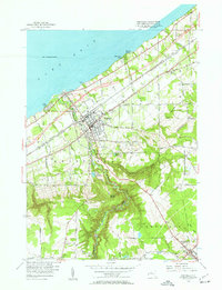
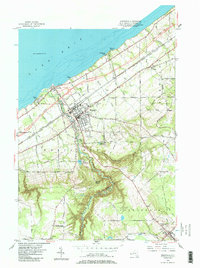
1954 Map of Westfield
USGS Topo · Published 1963About this map
Westfield sits as the central hub of this mid-century survey, positioned where the industrial corridor of the Lake Erie shoreline meets the rising terrain of the Chautauqua ridge. The map captures the significant infrastructure of the 1950s, including the newly established New York State Thruway and its Interchange 60, which began to redefine local transit alongside the established New York Central and St Louis Railroad.
Find a feature on this map
97 named features on this map. Tap any name to fly to it.
Don’t see what you’re looking for? This feature index may not catch every label — zoom into the map to look around manually.
Map Details
Editions of this 1954 Westfield Map
5 editions found
Other maps of this area

1899 · Westfield
USGS Topo · 1:62,500

1900 · Dunkirk
USGS Topo · 1:62,500

1904 · Chautaqua
USGS Topo · 1:62,500

1905 · Clymer
USGS Topo · 1:62,500

1939 · Clymer
USGS Topo · 1:62,500

1941 · Chautauqua
USGS Topo · 1:62,500

1941 · Clymer
USGS Topo · 1:62,500

1943 · Dunkirk
USGS Topo · 1:62,500

1954 · Chautauqua
USGS Topo · 1:24,000

1954 · South Ripley
USGS Topo · 1:24,000