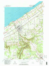
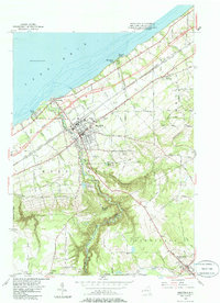
1954 Map of Westfield
USGS Topo · Published 1985About this map
Lake Erie defines the northern edge of this Chautauqua County landscape, where the lakefront village of Barcelona serves as a historic gateway just west of the mouth of Chautauqua Creek. Moving inland, the village of Westfield stands as a central hub, flanked by early industrial and infrastructure markers like the Sewage Disposal plant and an Airway Beacon. The terrain rises sharply toward the south, carved by the dramatic Gulf the Chautauqua Creek, leading toward the village of Mayville. Mid-century cultural life is evidenced by the Drive-in Theater near Spring Creek, while the region's spiritual and genealogical history is anchored by several burial grounds, including Old St James Cemetery and Volusia Cem. Transportation networks are prominent, featuring the New York State Thruway and several rail lines, including an Old Railroad Grade that suggests earlier patterns of movement through the hills.
Find a feature on this map
44 named features on this map. Tap any name to fly to it.
Don’t see what you’re looking for? This feature index may not catch every label — zoom into the map to look around manually.
Map Details
Editions of this 1954 Westfield Map
5 editions found
Other maps of this area

1899 · Westfield
USGS Topo · 1:62,500

1900 · Dunkirk
USGS Topo · 1:62,500

1904 · Chautaqua
USGS Topo · 1:62,500

1905 · Clymer
USGS Topo · 1:62,500

1939 · Clymer
USGS Topo · 1:62,500

1941 · Chautauqua
USGS Topo · 1:62,500

1941 · Clymer
USGS Topo · 1:62,500

1943 · Dunkirk
USGS Topo · 1:62,500

1954 · Chautauqua
USGS Topo · 1:24,000

1954 · South Ripley
USGS Topo · 1:24,000