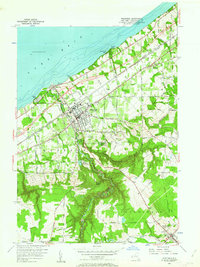
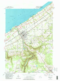
1954 Map of Westfield
USGS Topo · Published 1963About this map
Lake Erie defines the northern edge of this Chautauqua County landscape, where the lakefront village of Barcelona serves as a historic harbor near the mouth of Chautauqua Creek. Moving inland, the village of Westfield sits at the intersection of major transportation corridors, including the Erie Thruway and several rail lines like the New York Chicago and St Louis Railroad. The terrain shifts dramatically south of town into the deep gorge of The Gulf, a winding canyon carved by the creek.
Find a feature on this map
85 named features on this map. Tap any name to fly to it.
Don’t see what you’re looking for? This feature index may not catch every label — zoom into the map to look around manually.
Map Details
Editions of this 1954 Westfield Map
5 editions found
Other maps of this area

1899 · Westfield
USGS Topo · 1:62,500

1900 · Dunkirk
USGS Topo · 1:62,500

1904 · Chautaqua
USGS Topo · 1:62,500

1905 · Clymer
USGS Topo · 1:62,500

1939 · Clymer
USGS Topo · 1:62,500

1941 · Chautauqua
USGS Topo · 1:62,500

1941 · Clymer
USGS Topo · 1:62,500

1943 · Dunkirk
USGS Topo · 1:62,500

1954 · Chautauqua
USGS Topo · 1:24,000

1954 · South Ripley
USGS Topo · 1:24,000