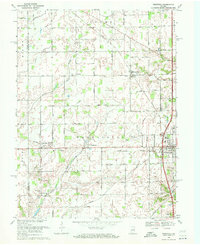
1969 Map of Westfield
USGS Topo · Published 1971About this map
Westfield serves as the primary hub in this late-1960s landscape, where the Monon railroad corridor cuts a diagonal path toward the surrounding rural townships of Adams, Washington, and Jackson. The area is characterized by a dense grid of range roads including West 161st Street and East 191st Street, connecting smaller agricultural hamlets like Jolietville, Eagletown, and Hortonville. Local history is deeply etched into the countryside through institutions such as Union Grove Ch and Little Eagle Creek Ch, alongside several quiet burial grounds like Chester Cem and Summit Lawn Cem. The survey also documents the early aviation footprint of the region with the Westfield Landing Strip situated north of the main settlement. The drainage patterns of Eagle Creek and Finley Creek contrast with the straight-line precision of the county's established roadway and rail infrastructure.
Find a feature on this map
47 named features on this map. Tap any name to fly to it.
Don’t see what you’re looking for? This feature index may not catch every label — zoom into the map to look around manually.
Map Details
Editions of this 1969 Westfield Map
2 editions found
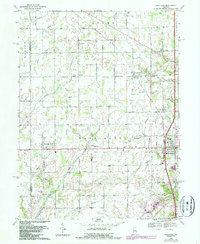
Other maps of this area

1952 · Fishers
USGS Topo · 1:24,000

1952 · Carmel
USGS Topo · 1:24,000

1953 · Westfield
USGS Topo · 1:24,000

1953 · Rosston
USGS Topo · 1:24,000

1953 · Zionsville
USGS Topo · 1:24,000

1953 · Noblesville
USGS Topo · 1:24,000

1953 · Danville
USGS Topo · 1:250,000

1953 · Indianapolis
USGS Topo · 1:250,000

1955 · Danville
USGS Topo · 1:250,000

1956 · Danville
USGS Topo · 1:250,000