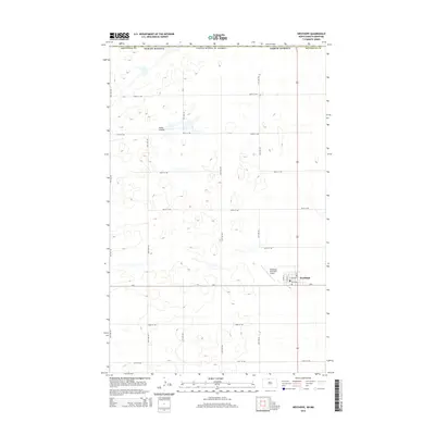
2014 Map of Westhope
USGS Topo · Published 2014About this map
Westhope occupies the southeastern corner of this North Dakota survey, positioned at the junction of 83 and CR-6. The town's grid is clearly defined by local routes such as E 1st Ave and E 3rd Ave, with the Westhope Municipal Airport situated just to the west. This agricultural landscape is part of the Great Plains, where the terrain is marked by the drainage of Hulse Coulee and a network of section-line roads, including 108th St NW and 101st St NW, that stretch across the prairie toward the border with Canada. The map illustrates a highly organized rural infrastructure, where the township and range system remains the primary influence on the placement of farmsteads and transport corridors in Bottineau County.
Find a feature on this map
17 named features on this map. Tap any name to fly to it.
Don’t see what you’re looking for? This feature index may not catch every label — zoom into the map to look around manually.
Map Details
Editions of this 2014 Westhope Map
This is the sole edition of this map. No revisions or reprints were ever made.
Other maps of this area

1949 · Landa
USGS Topo · 1:24,000

1949 · Westhope SW
USGS Topo · 1:24,000

1949 · Landa SW
USGS Topo · 1:24,000

1950 · Westhope SW
USGS Topo · 1:24,000

1950 · Landa
USGS Topo · 1:24,000

1950 · Landa SW
USGS Topo · 1:24,000

1951 · Westhope SE
USGS Topo · 1:24,000
1951 · Kuroki
USGS Topo · 1:24,000
1951 · Westhope
USGS Topo · 1:24,000

1954 · Minot
USGS Topo · 1:250,000