
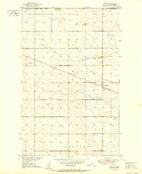
1951 Map of Westhope SE
USGS Topo · Published 1951About this map
Civil townships and scattered rural landmarks define this prairie landscape in Bottineau County, surveyed for the development of the Missouri River Basin. The territory is divided into the administrative blocks of Bentinck, Sergius, Hastings, and Brander, where the economy was rooted in small-scale farming and local community centers. Cultural life in the early 1950s centered on sites like St Paul Ch and the centrally located Town Hall. The presence of the Weak Cem provides a specific point of interest for genealogists tracing early families in this section of the Great Plains. The topography, mapped via plane-table methods and aerial photography from 1948, shows the subtle drainage patterns and depressions characteristic of this northern region near the Canadian border.
Find a feature on this map
7 named features on this map. Tap any name to fly to it.
Don’t see what you’re looking for? This feature index may not catch every label — zoom into the map to look around manually.
Map Details
Editions of this 1951 Westhope SE Map
This is the sole edition of this map. No revisions or reprints were ever made.
Other maps of this area

1949 · Maxbass
USGS Topo · 1:24,000

1949 · Eckman
USGS Topo · 1:24,000

1949 · Landa
USGS Topo · 1:24,000

1949 · Westhope SW
USGS Topo · 1:24,000

1949 · Landa SW
USGS Topo · 1:24,000

1950 · Newburg
USGS Topo · 1:24,000

1950 · Westhope SW
USGS Topo · 1:24,000

1950 · Landa
USGS Topo · 1:24,000

1950 · Landa SW
USGS Topo · 1:24,000
1951 · Kuroki
USGS Topo · 1:24,000