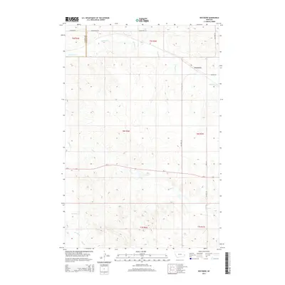
2014 Map of Westmore
USGS Topo · Published 2014About this map
Westmore sits near the eastern edge of this Montana landscape, where the prairie is defined by a sparse network of drainage systems and long-distance road corridors. The township is characterized by the convergence of local routes like Westmore Rd and Cemetery Rd near the settlement, which serve a vast area of sections and townships including t9n r56e and t8n r57e. The drainage pattern is established by several seasonal watercourses, most notably Sandstone Cr and Hay Cr, which carve subtle relief into the High Plains.
Find a feature on this map
18 named features on this map. Tap any name to fly to it.
Don’t see what you’re looking for? This feature index may not catch every label — zoom into the map to look around manually.
Map Details
Editions of this 2014 Westmore Map
This is the sole edition of this map. No revisions or reprints were ever made.
Other maps of this area

1953 · Miles City
USGS Topo · 1:250,000

1957 · Miles City
USGS Topo · 1:250,000

1958 · Miles City
USGS Topo · 1:250,000

1981 · Baker
USGS Topo · 1:100,000

1981 · Lawrence Creek West
USGS Topo · 1:24,000

1981 · Little Pine Creek
USGS Topo · 1:24,000
1981 · Ismay North
USGS Topo · 1:24,000

1981 · Bracket Butte SE
USGS Topo · 1:24,000

1981 · Ayer Spring
USGS Topo · 1:24,000
1981 · Plevna
USGS Topo · 1:24,000