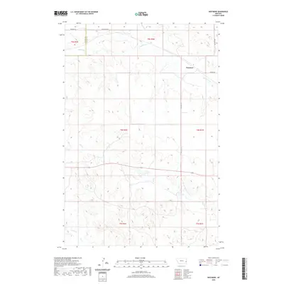
2020 Map of Westmore
USGS Topo · Published 2020About this map
Westmore sits in the high plains of eastern Montana, positioned along the county line between Custer and Fallon Counties. This region is defined by its intermittent drainage networks, most notably Sandstone Cr and Hay Cr, which carve subtle patterns into the open terrain. The mapping reveals a sparse but methodical road system following section lines, including Yellowstone Rd and Westmore Rd, reflecting the expansive agricultural and ranching legacy of the area.
Find a feature on this map
15 named features on this map. Tap any name to fly to it.
Don’t see what you’re looking for? This feature index may not catch every label — zoom into the map to look around manually.
Map Details
Editions of this 2020 Westmore Map
This is the sole edition of this map. No revisions or reprints were ever made.
Other maps of this area

1953 · Miles City
USGS Topo · 1:250,000

1957 · Miles City
USGS Topo · 1:250,000

1958 · Miles City
USGS Topo · 1:250,000

1981 · Baker
USGS Topo · 1:100,000

1981 · Lawrence Creek West
USGS Topo · 1:24,000

1981 · Little Pine Creek
USGS Topo · 1:24,000
1981 · Ismay North
USGS Topo · 1:24,000

1981 · Bracket Butte SE
USGS Topo · 1:24,000

1981 · Ayer Spring
USGS Topo · 1:24,000
1981 · Plevna
USGS Topo · 1:24,000