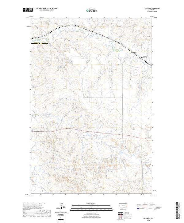
2024 Map of Westmore
USGS Topo · Published 2024About this map
The settlement of Westmore anchors this high plains landscape on the eastern edge of Montana, marking a point where the open prairie is bisected by the drainages of Sandstone Creek and Hay Creek. The area retains its rural character, defined by large-scale ranching or agricultural divisions and the quiet presence of the Westmore Cem along Cemetery Rd. This 2024 survey illustrates a terrain deeply influenced by the seasonal hydrology of O'Fallon Creek and Pine Creek, which carve winding paths through the undulating topography. The map illustrates the sparse road network typical of Fallon County, including Yellowstone Rd and Westmore Rd, which provide the primary access to the remote homesteads and sections that comprise the township grid.
Find a feature on this map
16 named features on this map. Tap any name to fly to it.
Don’t see what you’re looking for? This feature index may not catch every label — zoom into the map to look around manually.
Map Details
Editions of this 2024 Westmore Map
This is the sole edition of this map. No revisions or reprints were ever made.
Other maps of this area

1953 · Miles City
USGS Topo · 1:250,000

1957 · Miles City
USGS Topo · 1:250,000

1958 · Miles City
USGS Topo · 1:250,000

1981 · Baker
USGS Topo · 1:100,000

1981 · Lawrence Creek West
USGS Topo · 1:24,000

1981 · Little Pine Creek
USGS Topo · 1:24,000
1981 · Ismay North
USGS Topo · 1:24,000

1981 · Bracket Butte SE
USGS Topo · 1:24,000

1981 · Ayer Spring
USGS Topo · 1:24,000
1981 · Plevna
USGS Topo · 1:24,000