1964 Map of Westmoreland
USGS Topo · Published 1983About this map
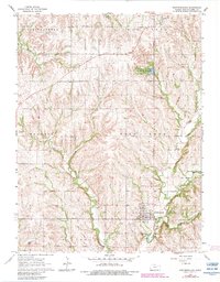
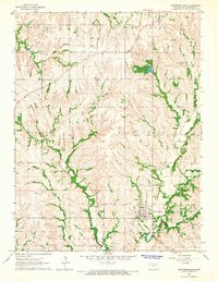
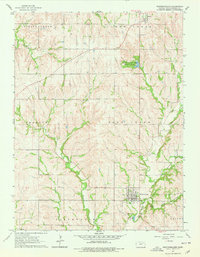
Westmoreland serves as a focal point for this survey of northeast Kansas, showing a well-defined grid of residential blocks and local infrastructure. The surrounding landscape is carved by several drainages, including Rock Creek and Wilson Creek, which flow through a mix of upland territory and deeper draws like Dutch Hollow. To the north, the Pottawatomie County No 1 State Fishing Lake and Wildlife Area provides a significant water feature and recreational tract. The area’s spiritual and community history is anchored by St Columbkilles Ch near Blaine, while several small burial sites like Huff Cem and Moodyville Cem are scattered across the townships of Shannon and Clear Creek. This map captures a rural Kansas interior where early pioneer landmarks, such as Mount Ephraim, remained central reference points for the 20th-century community.
Find a feature on this map
26 named features on this map. Tap any name to fly to it.
Don’t see what you’re looking for? This feature index may not catch every label — zoom into the map to look around manually.
Map Details
Editions of this 1964 Westmoreland Map
3 editions found
Other maps of this area

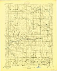
1886 · Junction City
USGS Topo · 1:125,000

1889 · Seneca
USGS Topo · 1:125,000

1889 · Wamego
USGS Topo · 1:125,000

1889 · Marysville
USGS Topo · 1:125,000

1889 · Junction City
USGS Topo · 1:125,000

1894 · Junction City
USGS Topo · 1:125,000
1894 · Seneca
USGS Topo · 1:125,000

1894 · Marysville
USGS Topo · 1:125,000

1894 · Wamego
USGS Topo · 1:125,000

1955 · Manhattan
USGS Topo · 1:250,000