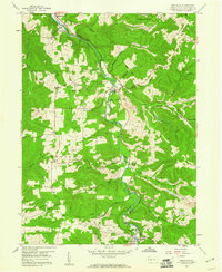
1959 Map of Westover
USGS Topo · Published 1960About this map
Chest Creek carves a deep valley through this portion of Clearfield County, serving as the central corridor for both the Pennsylvania Railroad and Pennsylvania Highway 36. The landscape in the late 1950s is defined by a dense network of extraction, with numerous strip mines and tipples flanking the hillsides above settlements like Mahaffey and Westover. Significant local landmarks provide evidence of community life, including the Mahaffey Racetrack in the north and several rural congregations such as Mt Joy Ch and Mt Zion Ch. Genealogists will find many family burial grounds and small cemeteries, such as La Jose Cem and Cross Cem, scattered across the highlands between Snyder Run and Rattling Run. The transition between the boroughs of New Washington and Newburg highlights the period's rural settlement patterns and industrial infrastructure.
Find a feature on this map
49 named features on this map. Tap any name to fly to it.
Don’t see what you’re looking for? This feature index may not catch every label — zoom into the map to look around manually.
Map Details
Editions of this 1959 Westover Map
3 editions found
Other maps of this area

1902 · Patton
USGS Topo · 1:62,500

1902 · Barnesboro
USGS Topo · 1:62,500

1903 · Curwensville
USGS Topo · 1:62,500

1904 · Barnesboro
USGS Topo · 1:62,500

1904 · Patton
USGS Topo · 1:62,500

1906 · Punxsutawney
USGS Topo · 1:62,500

1939 · Curwensville
USGS Topo · 1:62,500

1939 · Punxsutawney
USGS Topo · 1:62,500

1942 · Curwensville
USGS Topo · 1:62,500

1942 · Punxsutawney
USGS Topo · 1:62,500