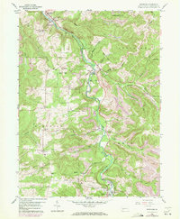
1959 Map of Westover
USGS Topo · Published 1972About this map
Chest Creek carves a winding path through this Clearfield County landscape, serving as the primary corridor for the Penn Central railroad and a string of riverside settlements. This 1959 survey, updated in the early 1970s, captures a transition in the local economy as traditional extraction meets mid-century infrastructure. Industry is evident in the Strip Mines dotting the northern hills and the Kings Mine to the south, supported by technical features like a Tipple, Tailings, and a Radio Range Station.
Find a feature on this map
46 named features on this map. Tap any name to fly to it.
Don’t see what you’re looking for? This feature index may not catch every label — zoom into the map to look around manually.
Map Details
Editions of this 1959 Westover Map
3 editions found
Other maps of this area

1902 · Patton
USGS Topo · 1:62,500

1902 · Barnesboro
USGS Topo · 1:62,500

1903 · Curwensville
USGS Topo · 1:62,500

1904 · Barnesboro
USGS Topo · 1:62,500

1904 · Patton
USGS Topo · 1:62,500

1906 · Punxsutawney
USGS Topo · 1:62,500

1939 · Curwensville
USGS Topo · 1:62,500

1939 · Punxsutawney
USGS Topo · 1:62,500

1942 · Curwensville
USGS Topo · 1:62,500

1942 · Punxsutawney
USGS Topo · 1:62,500