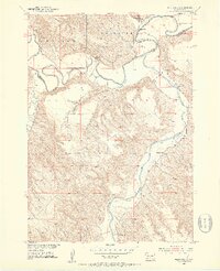
1951 Map of Westover
USGS Topo · Published 1953About this map
The White River carves a deep, winding path through this central South Dakota landscape, defining the border between Jones and Mellette counties. At the confluence of Horse Creek and the main river, the small settlement of Westover serves as a focal point in an otherwise sparse prairie terrain. The map illustrates the rural infrastructure of the early 1950s, where life revolved around the river valleys and high bluffs like Mullen. Notable landmarks include St Philip Ch and St Marys Ch, alongside the Riverview Sch, which provided essential community hubs for the scattered ranching families. The complex drainage network of the South Fork White River and Cottonwood Creek highlights the erosive nature of the geography during this period of Missouri River Basin development.
Find a feature on this map
11 named features on this map. Tap any name to fly to it.
Don’t see what you’re looking for? This feature index may not catch every label — zoom into the map to look around manually.
Map Details
Editions of this 1951 Westover Map
3 editions found
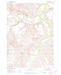
Other maps of this area

1951 · Murdo SE
USGS Topo · 1:24,000

1951 · White River NE
USGS Topo · 1:24,000

1951 · Westover
USGS Topo · 1:24,000

1951 · Murdo SW
USGS Topo · 1:24,000

1951 · Murdo 3 NE
USGS Topo · 1:24,000

1951 · Okaton SE
USGS Topo · 1:24,000

1955 · Martin
USGS Topo · 1:250,000

1958 · Martin
USGS Topo · 1:250,000

1982 · White River SE
USGS Topo · 1:24,000

1982 · White River East
USGS Topo · 1:24,000