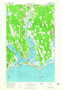
1963 Map of Westport
USGS Topo · Published 1965About this map
Westport River splits into two expansive branches, defining a landscape shaped by coastal estuaries and colonial-era settlement patterns. At the northern tidewater limit, the Head of Westport serves as a historic point of navigation, while downstream, the village of Westport Point occupies a narrow peninsula between the East Branch and West Branch. This 1963 revision documents a coastal economy transitioning from its maritime roots toward recreation, evidenced by the Westport Yacht Club and the sprawling Horseneck Beach State Reservation. Inland, the map captures numerous family-named crossroads such as Kirby Corner, Sissons Corner, and Handy Four Corners, which reflect the long-standing agricultural divisions of Bristol County. The eastern edge features Russells Mills, where the landscape begins to drain into the Slocums River and Buzzards Bay.
Find a feature on this map
86 named features on this map. Tap any name to fly to it.
Don’t see what you’re looking for? This feature index may not catch every label — zoom into the map to look around manually.
Map Details
Editions of this 1963 Westport Map
3 editions found
Other maps of this area

1885 · New Bedford
USGS Topo · 1:62,500

1885 · Sakonnet
USGS Topo · 1:62,500

1888 · New Bedford
USGS Topo · 1:62,500

1888 · Fall River
USGS Topo · 1:62,500

1888 · Sakonnet
USGS Topo · 1:62,500

1893 · Sakonnet
USGS Topo · 1:62,500

1893 · Fall River
USGS Topo · 1:62,500

1893 · New Bedford
USGS Topo · 1:62,500

1918 · New Bedford
USGS Topo · 1:62,500

1919 · Fall River
USGS Topo · 1:62,500