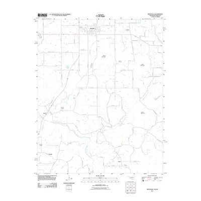
2011 Map of Westville
USGS Topo · Published 2011About this map
Westville serves as the primary hub in this eastern Oklahoma landscape, where the town grid meets a network of rural roads along the border with Arkansas. The terrain is defined by prominent rises such as Alberty Mountain and Snake Mountain, while the hydrology is dominated by the winding course of the Baron Fork and its tributaries like Shell Branch and Peavine Creek. Smaller communities including Baron, Peavine, and Piney are scattered through the valleys, reflecting a settlement pattern deeply tied to the local watercourses and mountain gaps.
Find a feature on this map
70 named features on this map. Tap any name to fly to it.
Don’t see what you’re looking for? This feature index may not catch every label — zoom into the map to look around manually.
Map Details
Editions of this 2011 Westville Map
This is the sole edition of this map. No revisions or reprints were ever made.
Other maps of this area

1898 · Tahlequah
USGS Topo · 1:125,000

1898 · Winslow
USGS Topo · 1:125,000

1899 · Fayetteville
USGS Topo · 1:125,000

1899 · Siloam Springs
USGS Topo · 1:125,000

1901 · Winslow
USGS Topo · 1:125,000

1901 · Fayetteville
USGS Topo · 1:125,000

1901 · Tahlequah
USGS Topo · 1:125,000

1903 · Siloam Springs
USGS Topo · 1:125,000

1904 · Siloam Springs
USGS Topo · 1:125,000

1904 · Fayetteville
USGS Topo · 1:125,000