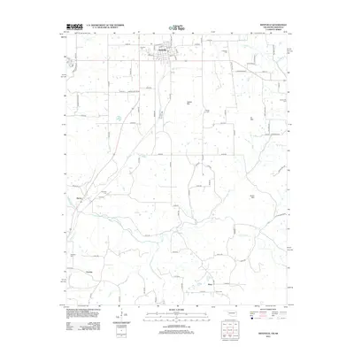
2012 Map of Westville
USGS Topo · Published 2012About this map
Westville serves as the focal point of this 2012 survey, situated near the intersection of the Oklahoma-Arkansas border defined by State Line Rd. The landscape is defined by the winding course of the Baron Fork and its various tributaries, including Shell Br, Peavine Cr, and Evansville Cr. Several prominent elevations like Alberty Mtn and Snake Mtn break the terrain, while the Westville Reservoir sits just west of the town center. Local history is deeply etched into the land through numerous family and community burial grounds, such as Foreman Cem, Crittenden Cem, and Ganderville Cem, which are scattered throughout the rural sections near Baron, Peavine, and Piney. The map documents a classic Ozark foothills settlement pattern where small communities and homesteads are linked by a dense network of section-line roads and named routes like Ross Swimmer Rd and Hammer Hollow Rd.
Find a feature on this map
86 named features on this map. Tap any name to fly to it.
Don’t see what you’re looking for? This feature index may not catch every label — zoom into the map to look around manually.
Map Details
Editions of this 2012 Westville Map
This is the sole edition of this map. No revisions or reprints were ever made.
Other maps of this area

1898 · Tahlequah
USGS Topo · 1:125,000

1898 · Winslow
USGS Topo · 1:125,000

1899 · Fayetteville
USGS Topo · 1:125,000

1899 · Siloam Springs
USGS Topo · 1:125,000

1901 · Winslow
USGS Topo · 1:125,000

1901 · Fayetteville
USGS Topo · 1:125,000

1901 · Tahlequah
USGS Topo · 1:125,000

1903 · Siloam Springs
USGS Topo · 1:125,000

1904 · Siloam Springs
USGS Topo · 1:125,000

1904 · Fayetteville
USGS Topo · 1:125,000