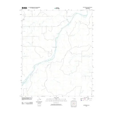
2010 Map of Wetumka SE
USGS Topo · Published 2010About this map
The Canadian River meanders diagonally across this Hughes County landscape, defining the hydrological character of the region. Significant tributaries including Sandy Creek, Gobbler Creek, and Scipio Creek carve through the terrain, illustrating the intricate drainage patterns north and south of the riverbed. Near the center of the map, the Perry S Burleson Dam stands as a notable modification to the natural water flow, while the northern reaches include the historic Lamar Cemetery, a vital site for local genealogical research. The map reveals a transition between the wide, braided channels of the Canadian River and the smaller, named creeks like Beaver Creek and Big Wildhorse Creek that feed into the larger system. A regular grid of rural roads, such as E W 131 RD and N S 388 RD, provides access to these isolated watercourses and landmarks, reflecting the organized settlement patterns of rural Oklahoma.
Find a feature on this map
30 named features on this map. Tap any name to fly to it.
Don’t see what you’re looking for? This feature index may not catch every label — zoom into the map to look around manually.
Map Details
Editions of this 2010 Wetumka SE Map
This is the sole edition of this map. No revisions or reprints were ever made.
Other maps of this area

1896 · Coalgate
USGS Topo · 1:125,000

1898 · McAlester
USGS Topo · 1:125,000

1899 · Coalgate
USGS Topo · 1:125,000

1900 · Canadian
USGS Topo · 1:125,000

1900 · Wewoka
USGS Topo · 1:125,000

1900 · Coalgate
USGS Topo · 1:125,000

1909 · Mc Alester
USGS Topo · 1:125,000

1946 · Fort Smith
USGS Topo · 1:250,000

1950 · Mcalester
USGS Topo · 1:250,000

1954 · Oklahoma City
USGS Topo · 1:250,000