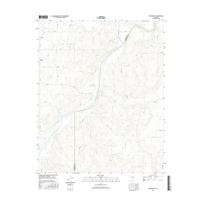
2016 Map of Wetumka SE
USGS Topo · Published 2016About this map
The Canadian River cuts a wide, meandering path through this borderland of Hughes and Pittsburg counties, defining the region's topography and drainage patterns. The settlement of Lamar sits in the northwest, serving as a focal point for the rural road network that follows section lines across the undulating terrain. Genealogists will find the Lamar Cem just north of the townsite, providing a significant touchstone for family history in this part of Oklahoma.
Find a feature on this map
25 named features on this map. Tap any name to fly to it.
Don’t see what you’re looking for? This feature index may not catch every label — zoom into the map to look around manually.
Map Details
Editions of this 2016 Wetumka SE Map
This is the sole edition of this map. No revisions or reprints were ever made.
Other maps of this area

1896 · Coalgate
USGS Topo · 1:125,000

1898 · McAlester
USGS Topo · 1:125,000

1899 · Coalgate
USGS Topo · 1:125,000

1900 · Canadian
USGS Topo · 1:125,000

1900 · Wewoka
USGS Topo · 1:125,000

1900 · Coalgate
USGS Topo · 1:125,000

1909 · Mc Alester
USGS Topo · 1:125,000

1946 · Fort Smith
USGS Topo · 1:250,000

1950 · Mcalester
USGS Topo · 1:250,000

1954 · Oklahoma City
USGS Topo · 1:250,000