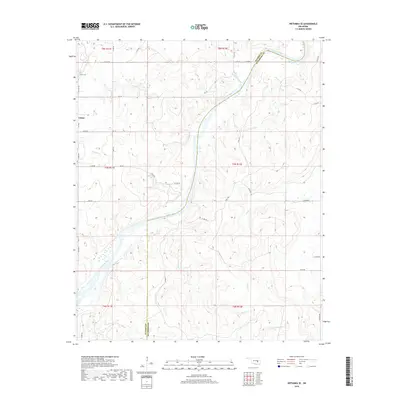
2018 Map of Wetumka SE
USGS Topo · Published 2018About this map
Lamar sits along the western edge of this Hughes County landscape, anchored by the Lamar Cem and a grid of rural section roads. The terrain is defined by the winding course of the Canadian River, which cuts diagonally across the center of the sheet, separating the rolling uplands of the northwest from the drainage basins of the southeast. Numerous small waterways, including Sandy Cr and Gobbler Creek, flow through the dissected topography toward the river valley. The eastern boundary of the map follows the county line between Hughes and Pittsburg counties. This 2018 survey illustrates a rural Oklahoma landscape dominated by traditional township and range divisions, where development is largely confined to the small settlement of Lamar and a network of county roads such as Ew 131 RD and N S 387.
Find a feature on this map
43 named features on this map. Tap any name to fly to it.
Don’t see what you’re looking for? This feature index may not catch every label — zoom into the map to look around manually.
Map Details
Editions of this 2018 Wetumka SE Map
This is the sole edition of this map. No revisions or reprints were ever made.
Other maps of this area

1896 · Coalgate
USGS Topo · 1:125,000

1898 · McAlester
USGS Topo · 1:125,000

1899 · Coalgate
USGS Topo · 1:125,000

1900 · Canadian
USGS Topo · 1:125,000

1900 · Wewoka
USGS Topo · 1:125,000

1900 · Coalgate
USGS Topo · 1:125,000

1909 · Mc Alester
USGS Topo · 1:125,000

1946 · Fort Smith
USGS Topo · 1:250,000

1950 · Mcalester
USGS Topo · 1:250,000

1954 · Oklahoma City
USGS Topo · 1:250,000