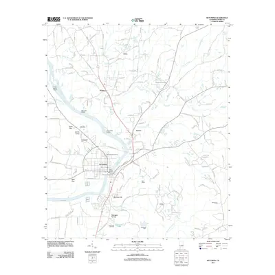
2011 Map of Wetumpka
USGS Topo · Published 2011About this map
The Coosa River anchors this study of Elmore County, defining the geography of Wetumpka and its outlying communities. The river’s descent is marked by numerous navigational hazards, including Grays Island Shoal, Moccasin Shoals, and the Corn Creek Shoals, which contrast with the modern infrastructure of the Bibb Graves Bridge. This transition from the white-water shoals to the managed flow near Wetumpka Falls illustrates the enduring importance of the river to the local economy and urban development.
Find a feature on this map
126 named features on this map. Tap any name to fly to it.
Don’t see what you’re looking for? This feature index may not catch every label — zoom into the map to look around manually.
Map Details
Editions of this 2011 Wetumpka Map
This is the sole edition of this map. No revisions or reprints were ever made.
Other maps of this area

1901 · Wetumpka
USGS Topo · 1:125,000

1901 · Wetumpka
USGS Topo · 1:62,500

1903 · Wetumpka
USGS Topo · 1:125,000

1927 · Montgomery
USGS Topo · 1:48,000

1930 · Montgomery
USGS Topo · 1:62,500

1953 · Montgomery
USGS Topo · 1:250,000

1956 · Montgomery
USGS Topo · 1:250,000

1957 · Montgomery
USGS Topo · 1:250,000

1958 · Montgomery
USGS Topo · 1:62,500

1958 · Montgomery North
USGS Topo · 1:24,000