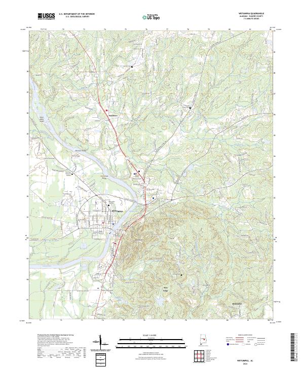
2024 Map of Wetumpka
USGS Topo · Published 2024About this map
The Coosa River defines the western corridor of this landscape, carving through a series of significant whitewater features including Moccasin Shoals, Corn Creek Shoals, and the dramatic Wetumpka Falls. As the river passes through the historic city of Wetumpka, it transitions from the rocky shoals of the fall line toward the coastal plain. The settlement pattern reflects this geography, with the core of Wetumpka and the Elmore County Judicial Complex situated along the riverbanks, while the smaller communities of Wallsboro and Redland sit further inland. Higher elevations like Bald Knob and Blue Ridge rise above the river valley, providing a rugged backdrop to the local road network. Genealogists can find several local burial grounds, including the Wetumpka City Cem and the more secluded Harwell Cem and Batchler Cem north of town.
Find a feature on this map
145 named features on this map. Tap any name to fly to it.
Don’t see what you’re looking for? This feature index may not catch every label — zoom into the map to look around manually.
Map Details
Editions of this 2024 Wetumpka Map
This is the sole edition of this map. No revisions or reprints were ever made.
Other maps of this area

1901 · Wetumpka
USGS Topo · 1:125,000

1901 · Wetumpka
USGS Topo · 1:62,500

1903 · Wetumpka
USGS Topo · 1:125,000

1927 · Montgomery
USGS Topo · 1:48,000

1930 · Montgomery
USGS Topo · 1:62,500

1953 · Montgomery
USGS Topo · 1:250,000

1956 · Montgomery
USGS Topo · 1:250,000

1957 · Montgomery
USGS Topo · 1:250,000

1958 · Montgomery
USGS Topo · 1:62,500

1958 · Montgomery North
USGS Topo · 1:24,000