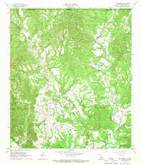
1965 Map of Weyanoke
USGS Topo · Published 1966About this map
Ellerslie Plantation and Feliciana Plantation sit at the heart of this mid-1960s landscape, reflecting the enduring agricultural footprint of West Feliciana Parish. The map reveals a transition from these historical estates to the active extraction industry of the era, evidenced by scattered Gravel Pits near Bayou Sara. The rugged topography is defined by the complex drainage of Little Bayou Sara and Sandy Creek, which cut through the hills south of the Mississippi-Louisiana state line.
Find a feature on this map
41 named features on this map. Tap any name to fly to it.
Don’t see what you’re looking for? This feature index may not catch every label — zoom into the map to look around manually.
Map Details
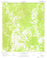
Editions of this 1965 Weyanoke Map
2 editions found
Other maps of this area

1906 · Bayou Sara
USGS Topo · 1:125,000

1936 · Woodville
USGS Topo · 1:62,500

1939 · St. Francisville
USGS Topo · 1:62,500

1939 · Artonish
USGS Topo · 1:62,500

1941 · Batchelor
USGS Topo · 1:62,500

1953 · Natchez
USGS Topo · 1:250,000

1954 · Elm Park
USGS Topo · 1:24,000

1954 · Artonish
USGS Topo · 1:62,500

1954 · Baton Rouge
USGS Topo · 1:250,000

1955 · Artonish
USGS Topo · 1:62,500