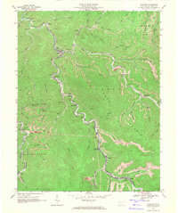
1968 Map of Wharton
USGS Topo · Published 1971About this map
The Chesapeake and Ohio railroad corridor dictates the industrial and residential patterns of this Boone County landscape, following the winding course of Pond Fork through the narrow valleys of Crook Mountain. This late 1960s survey documents a sequence of coal-related settlements and rail junctions, from the northern hamlets of Lanta and Bigson down to the southern communities of Barrett and Clinton. The topographical concentration of life is evident as churches like Elizabeth Ch and local education centers such as Wharton Jr High Sch are tightly clustered near the tracks and riverbanks.
Find a feature on this map
65 named features on this map. Tap any name to fly to it.
Don’t see what you’re looking for? This feature index may not catch every label — zoom into the map to look around manually.
Map Details
Editions of this 1968 Wharton Map
3 editions found
Other maps of this area

1891 · Oceana
USGS Topo · 1:125,000

1893 · Oceana
USGS Topo · 1:125,000

1898 · Oceana
USGS Topo · 1:125,000

1899 · Charleston
USGS Topo · 1:125,000

1909 · Peytona
USGS Topo · 1:48,000

1910 · Bald Knob
USGS Topo · 1:48,000

1911 · Peytona
USGS Topo · 1:62,500

1911 · Madison
USGS Topo · 1:62,500

1912 · Bald Knob
USGS Topo · 1:62,500

1913 · Logan
USGS Topo · 1:62,500