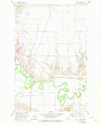
1958 Map of Whately
USGS Topo · Published 1978About this map
The meandering Milk River dominates this landscape in Valley County, creating a complex network of oxbows and bends that define the local geography. Just north of the river, the small settlement of Whately sits adjacent to the Burlington Northern railroad line, serving as a quiet point of transit in this high plains region. The terrain is characterized by dramatic shifts in elevation, from the prominent Tiger Butte in the south to the deeply carved Whately Coulee in the east.
Find a feature on this map
17 named features on this map. Tap any name to fly to it.
Don’t see what you’re looking for? This feature index may not catch every label — zoom into the map to look around manually.
Map Details
Editions of this 1958 Whately Map

Other maps of this area

1914 · Nashua
USGS Topo · 1:62,500

1916 · Nashua
USGS Topo · 1:62,500

1918 · Porcupine Valley
USGS Topo · 1:62,500

1943 · Glasgow
USGS Topo · 1:125,000

1954 · Glasgow
USGS Topo · 1:250,000

1957 · Glasgow
USGS Topo · 1:250,000

1958 · Glasgow
USGS Topo · 1:250,000

1958 · Glasgow
USGS Topo · 1:24,000
1958 · Blanchard Ranch
USGS Topo · 1:24,000

1958 · Wheeler
USGS Topo · 1:24,000