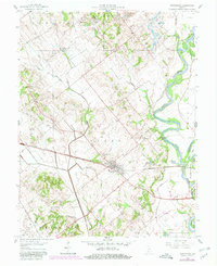
1958 Map of Wheatland
USGS Topo · Published 1980About this map
The town of Wheatland and the smaller Ragsdale cluster mark the high ground of the Steen and Palmyra townships in this mid-century survey. The landscape is defined by the winding course of the White River to the east, which contains Hyatt Island and is reinforced by the Bennington Levee. Regional infrastructure is dominated by the Baltimore and Ohio railroad corridor, which cuts an east-west path through the center of the sheet. Outside the primary settlements, the land reveals a mix of agricultural and industrial history, with the Indian Creek Settlement appearing in the north and various oil wells and a mine dump scattered across the undulating terrain. Small rural landmarks like Asbury Chapel and several marked cemeteries provide valuable data points for those tracing local family lineages in this river-and-rail corridor.
Find a feature on this map
33 named features on this map. Tap any name to fly to it.
Don’t see what you’re looking for? This feature index may not catch every label — zoom into the map to look around manually.
Map Details
Editions of this 1958 Wheatland Map
3 editions found
Other maps of this area

1942 · Fritchton
USGS Topo · 1:24,000

1943 · Oaktown
USGS Topo · 1:24,000

1943 · Bicknell
USGS Topo · 1:24,000

1943 · Plainville
USGS Topo · 1:24,000

1944 · Fritchton
USGS Topo · 1:24,000

1944 · Washington
USGS Topo · 1:24,000

1944 · Monroe City
USGS Topo · 1:24,000

1944 · Wheatland
USGS Topo · 1:24,000

1944 · Iona
USGS Topo · 1:24,000

1945 · Sandy Hook
USGS Topo · 1:24,000