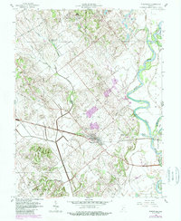
1958 Map of Wheatland
USGS Topo · Published 1988About this map
Wheatland serves as the central hub of this survey, where the Baltimore and Ohio RR cuts through the Indiana landscape just west of the White River. The topography reveals a mix of managed drainage systems like Opossum Ditch and Patrick Ditch alongside natural waterways such as Indian Creek and Flat Creek. Industrial and agricultural footprints are evident through the presence of a Mine Dump, Mine Pond, and several Oil Wells scattered across the township lines.
Find a feature on this map
33 named features on this map. Tap any name to fly to it.
Don’t see what you’re looking for? This feature index may not catch every label — zoom into the map to look around manually.
Map Details
Editions of this 1958 Wheatland Map
3 editions found
Other maps of this area

1942 · Fritchton
USGS Topo · 1:24,000

1943 · Oaktown
USGS Topo · 1:24,000

1943 · Bicknell
USGS Topo · 1:24,000

1943 · Plainville
USGS Topo · 1:24,000

1944 · Fritchton
USGS Topo · 1:24,000

1944 · Washington
USGS Topo · 1:24,000

1944 · Monroe City
USGS Topo · 1:24,000

1944 · Wheatland
USGS Topo · 1:24,000

1944 · Iona
USGS Topo · 1:24,000

1945 · Sandy Hook
USGS Topo · 1:24,000