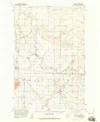
1956 Map of Wheeler
USGS Topo · Published 1960About this map
Irrigation infrastructure and railroad junctions define this mid-century landscape in the Columbia Basin. The expansion of the Columbia Basin Project is evident through the extensive network of the Low East Canal, various wasteway segments, and numerous siphon and pipeline crossings. Agricultural industry is anchored by a Sugar Refinery near the settlement of Wheeler, while the transportation network is dominated by the Northern Pacific and the Chicago Milwaukee St Paul and Pacific railroads.
Find a feature on this map
37 named features on this map. Tap any name to fly to it.
Don’t see what you’re looking for? This feature index may not catch every label — zoom into the map to look around manually.
Map Details
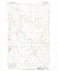
Editions of this 1956 Wheeler Map
2 editions found
Other maps of this area

1912 · Moses Lake
USGS Topo · 1:62,500

1916 · Connell
USGS Topo · 1:125,000

1918 · Connell
USGS Topo · 1:125,000

1923 · Corfu
USGS Topo · 1:62,500

1923 · Wheeler
USGS Topo · 1:62,500

1924 · Othello
USGS Topo · 1:62,500

1925 · Wheeler
USGS Topo · 1:62,500

1925 · Schrag
USGS Topo · 1:62,500

1951 · Corfu
USGS Topo · 1:62,500

1953 · Walla Walla
USGS Topo · 1:250,000